Every rupee tendered. Every ward's boundary. Every official's direct line. Nagrik drags the public record MCG and GMDA already owe you out of hundred-page PDFs and dead portals — onto one live map, free, open to anyone with a browser.
TRANSPARENCY IS NOT A FAVOUR ✶ THE RECORD WAS ALWAYS YOURS ✶ TRANSPARENCY IS NOT A FAVOUR ✶ THE RECORD WAS ALWAYS YOURS ✶ TRANSPARENCY IS NOT A FAVOUR ✶ THE RECORD WAS ALWAYS YOURS ✶ TRANSPARENCY IS NOT A FAVOUR ✶ THE RECORD WAS ALWAYS YOURS ✶ TRANSPARENCY IS NOT A FAVOUR ✶ THE RECORD WAS ALWAYS YOURS ✶ TRANSPARENCY IS NOT A FAVOUR ✶ THE RECORD WAS ALWAYS YOURS ✶
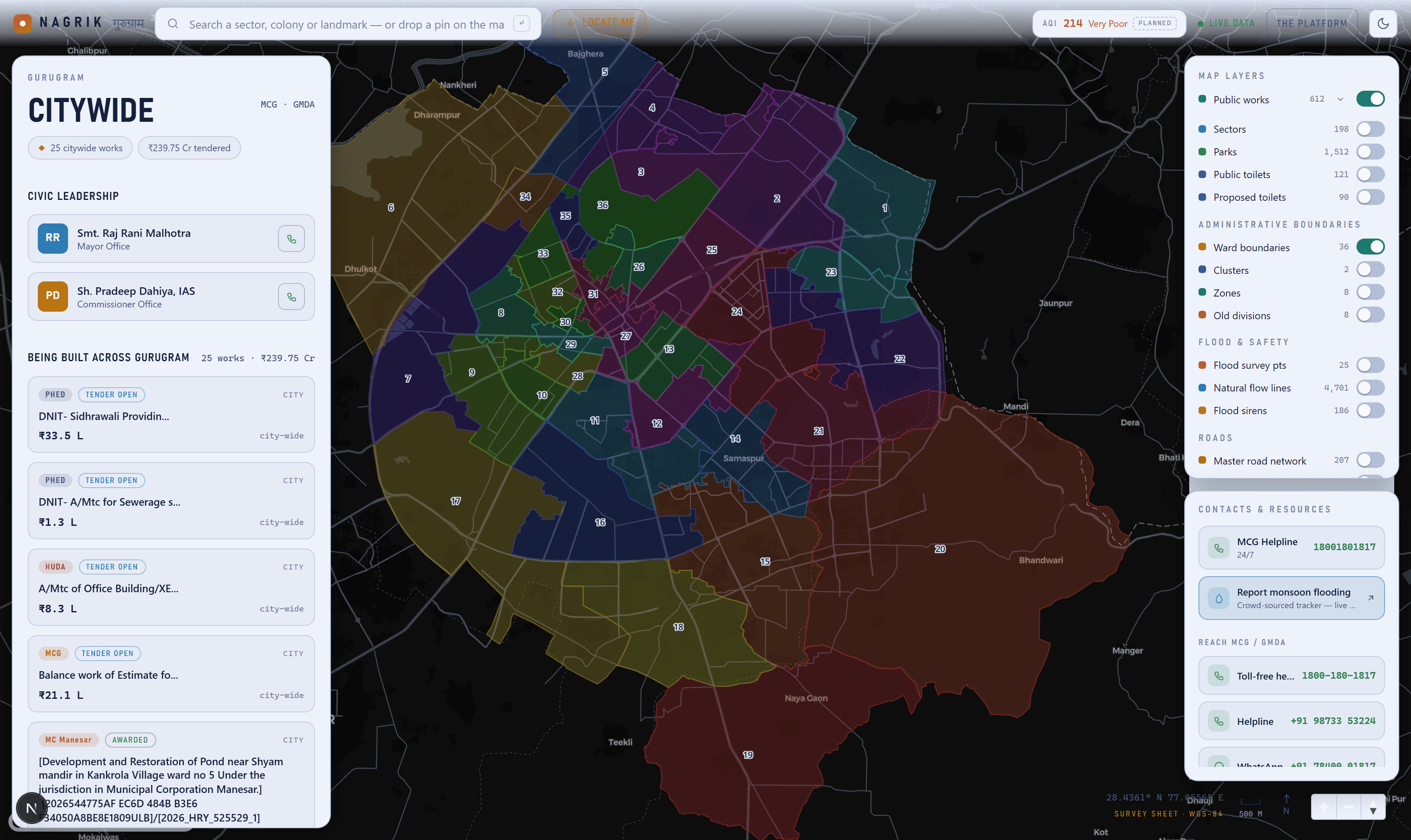
The whole city on one screen — 56 wards, live tenders, every contact, before you click anything.
Exhibit B
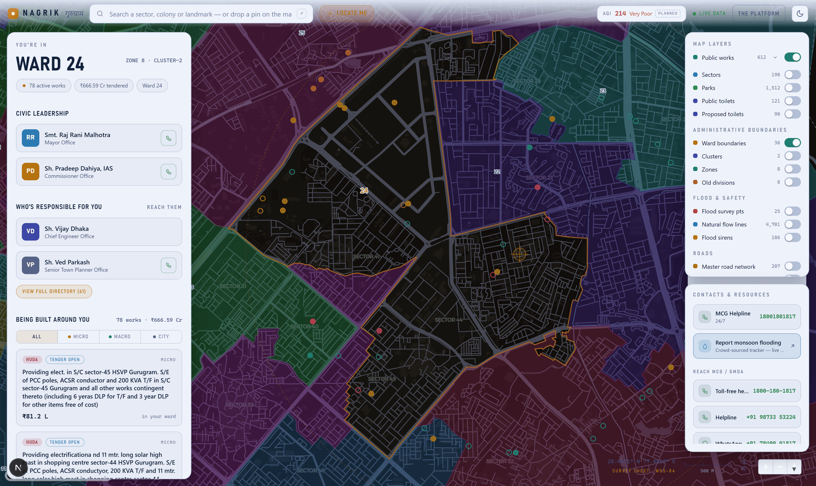
Drop a pin, meet your ward
The map zooms to the exact boundary and names who's responsible.
Exhibit C
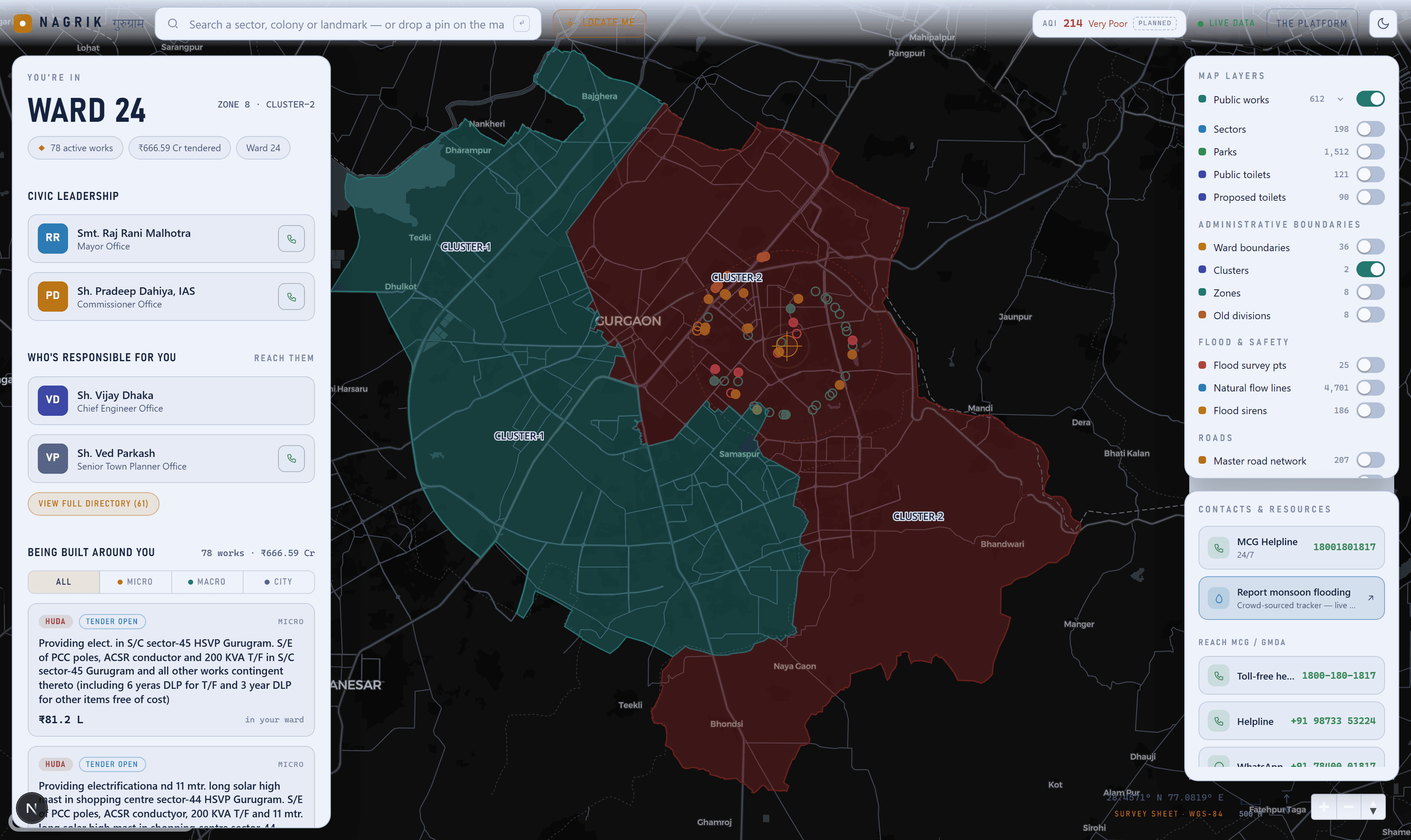
Every boundary drawn around you
Wards, clusters, zones, divisions — one at a time, never in conflict.
02 — THE LEDGER
30,000+ records. Zero of them hidden.
Nothing here sits in a spreadsheet nobody opens. Every source resolves to a specific place on the console — a layer, a rail, a detail sheet — keyed to a question a resident is actually asking.
693Public works
₹4,007 CrValue tracked
159Named officials
56Wards mapped
wards · 56 polygons
The base map, and your identity
Resolves any pin to “Ward 24 · Zone 8” via PostGIS — the anchor everything else hangs off.
projects · 693 works
Every tender, as a pin and a card
Split micro / macro / city-wide. ₹4,007 Cr of public work made legible on the map.
awarded · 308 contracts
The money trail
Who won the contract and for how much — the estimate replaced by the real awarded value.
officials · 159 officers
Who's responsible for you
Real, named department heads with one-tap call, grouped and colour-coded by role.
attachments · 740 files
The document trail
DNIT, notice, corrigendum, acceptance letter — the actual tender PDFs, one link away.
map_features · 36,228 objects
17 toggleable overlays
Parks, toilets, roads, sirens, clusters, zones, divisions — from GMDA OneMap and MCG.
flood + water · 9,000 pts
A monsoon-risk lens
Flow lines, watersheds, 186 sirens, 4,154 sensors, and a live crowd-sourced flood tracker.
helplines · 12 channels
Contacts & resources
Every real MCG/GMDA phone line, WhatsApp, email and grievance portal — not a dead PDF.
03 — IN THE OPEN
What's next — and who it's for.
Every item is free and deterministic — RSS, public records, open APIs, or data we already hold. The checked ones ship today; the rest is the recorded backlog, in the open.
Real helplines & full official directory159 named department heads, colour-coded by role, one tap from a phone call.
shipped
Every administrative boundary MCG drawsWards, clusters, zones, and old divisions — colour-coded, labelled, zoomable.
shipped
Monsoon flood reporting, liveA direct link to the crowd-sourced flood tracker — removed automatically off-season.
shipped
Live conditions stripAQI (CPCB / OpenAQ) plus weather (Open-Meteo) — Gurugram's two daily anxieties.
next · open API
Money-trail lensBiggest contracts, repeat winners, spend by ward. Built for RWAs and reporters.
next · data held
Watch your wardSubscribe to an alert when a new work is tendered near you. Staged last — needs accounts.
next · needs auth
04 — WHERE THIS COMES FROM
Credit where it's due.
Nagrik doesn't generate a single record on this site. MCG, MC Manesar and GMDA collect and publish every tender, boundary and officer listing here — often as a scanned PDF or a portal that's hard to search, but published all the same. We just pulled it onto one map. The exact upstream for every number, and how to get something corrected, is public.